2016 GeoRodeo
Annual Texas GeoDeveloper Round-Up, May 22nd, Austin, Texas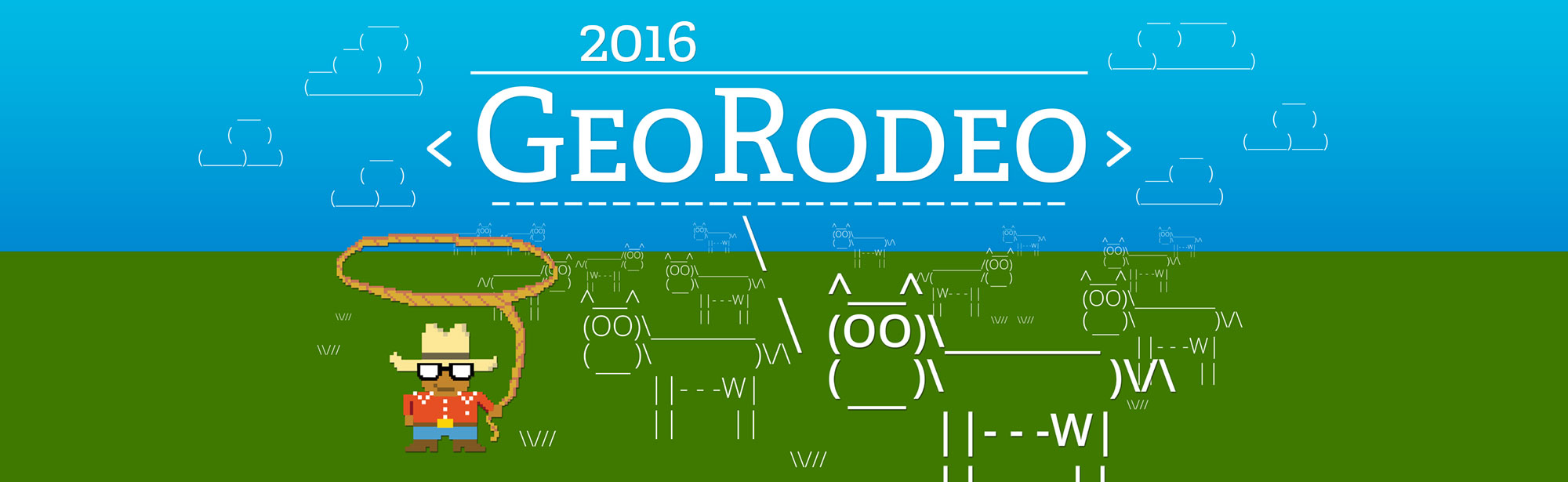
Code, Code on the Range
TNRIS invites you to Austin on May 20th, 2016, for the 4th annual GeoRodeo - a roundup of geodevelopers, coders and any professional from across the state of Texas who is looking to incorporate new ideas and creative solutions into their work.
This free, interactive, technical conference, held at the Commons Learning Center of the JJ Pickle Research Campus, is specifically for the Texas GIS/geospatial developer community.
Join us to learn about tips and techniques for open data, open source, and commercial GIS applications. Check out our preliminary agenda below.
 Keynote Speaker
Waldo Jaquith, U.S. Open Data
Waldo Jaquith is the director of U.S. Open Data, an organization building the capacity of open data and supporting government in that mission. He also serves as the senior technology advisor to the Sunlight Foundation. Previously, he worked for the White House Office of Science and Technology Policy on open data initiatives. He lives in Charlottesville, Virginia with his wife and son.
Other Presenters
Keep checking back as we confirm speakers.

Register for Free
Online Registration is now closed. Walk-ups are still welcome on the event date at the registration table on-site.
Sponsors


Become a sponsor of the GeoRodeo and connect with the Texas GeoDeveloper community.
Become a SponsorAgenda Overview
| 8:00AM to 8:45AM | Breakfast - Social Sponsored by ESRI |
| 8:45AM to 9:00AM |
Opening Remarks |
| 9:00AM to 10:00AM |
Keynote AddressWaldo Jaquith, U.S. Open Data |
| 10:00AM to 10:15AM | Break |
| 10:15AM to 11:45AM | |
| 11:45AM to 1:30PM | Lunch on your own |
| 1:30PM to 3:00PM | |
| 3:00PM to 3:15PM | Break |
| 3:15PM to 4:30PM | |
| 4:30PM to 5:15PM |
Lightning Talks |
| 5:15PM to 5:20PM |
Closing Remarks |
| 5:30PM |
Social TBA |
I am new to programming. Will I benefit from this?
Yes, this event is designed to help you make connections and provide some guidance for accomplishing your geospatial goals. There will be an emphasis on coding and breaking down the process for modern geospatial solutions.
Should I bring my own Laptop?
Yes, we encourage you to bring your own laptop loaded with whatever tools and code that you may want or need. There will be wireless internet connections available. Note: Make sure you have a fully charged battery to avoid power outlet ‘range wars’!
Code of Conduct
Attendees and participating organizations at the GeoRodeo are required to agree to a Code of Conduct
View Code of ConductNote: Preliminary agenda only. Check back for updates as times and presenters are confirmed.
8:00AM to 8:45AM
Breakfast – Social
Sponsored by 
8:45AM to 9:00AM
Opening Remarks
9:00AM to 10:00AM
Keynote Address
Waldo Jaquith, U.S. Open Data
About Waldo
Waldo Jaquith is the director of U.S. Open Data, an organization building the capacity of open data and supporting government in that mission. He also serves as the senior technology advisor to the Sunlight Foundation. Previously, he worked for the White House Office of Science and Technology Policy on open data initiatives. He lives in Charlottesville, Virginia with his wife and son.
10:00AM to 10:15AM
Break
10:15AM to 11:45AM
Andy Dearing, CEO BoundlessGeo
 Thinking Open – A Hybrid Approach to Implementing Open-Source Technologies
As open-source technology trends continue to emerge in modern IT enterprises, there has been significant interest from the geospatial community in implementing open-source GIS technologies. There are a multitude of reasons why organizations consider open-source, and in this discussion, Boundless will share best practices around a hybrid approach to integrating and implementing open-source geospatial technologies, complementing the existing proprietary technologies and tools.
About Andy
As a commercial pilot by schooling and a self-taught geographer by trade, Andy has been working with GIS for over the past 13 years. Andy works at Boundless, where he currently serves as the CEO and previously held the role of the Vice President of Professional Services. His team supports the promotion of open source geospatial technologies, as well as providing support for those needing a little help along the way. Prior to working at Boundless, Andy worked at Esri for 10 years leading the Midwest Professional Services delivery team. He lives in St. Louis with his wife and four kids, where he enjoys hiking, fishing, and being a novice woodworker, when is he is not camping out with the Boy Scouts!
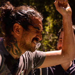
John Gravois - ESRI
 Hey Esri, What Have You Open-sourced for me Lately?
About John
John is a Developer Advocate who specializes in programming against both ArcGIS Server and Esri's SAS offerings. He has a tattoo of a California Raisin and when he's not in front of a computer you can often find him tangled up in poison oak somewhere near his mountain bike.
11:45AM to 1:30PM
Chow Time
Lunch on your own. Here's a map of nearby lunch spots:
1:30PM to 3:00PM
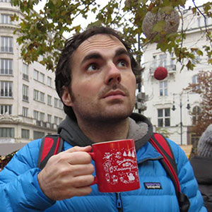
Stuart Lynn - CartoDB
 Data, Analysis, Cartography and Exploration with CartoDB: how to make the most of your geospatial data.
Geospatial data is almost unique in it's potential to join to other datasets. Having a point or an area on a map allows us to associate that data with vast amounts of other information about that place. At CartoDB we are building out tools and services that will dramatically increase your ability to easily augment your data with public data sets like the US Census and Zillow house prices. Once you have the information you need we are providing powerful analysis techniques and cartography to really help understand your data, present it to the rest of the world and to let other explore it. In this talk I will take you through how to do all these things and build out a interactive dashboard to show just how easy it is.
About Stuart
Stuart is a Map Scientist with CartoDB a company that specializes in beautiful online geospatial visualizations and location analytics. He initially studied mathematical physics at Edinburgh University before deciding astronomy was prettier and easier to explain in bars and obtained a Ph.D. in astrophysics. He currently works at the Adler Planetarium as the technical lead of the Zooniverse: the largest collection of online citizen science projects. He is passionate about getting everyone involved in doing real science and making real discoveries online.
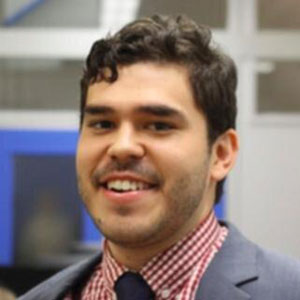
Mateo Clarke - Open Austin
About Mateo
Mateo Clarke is the Brigade Captain and Chair of Open Austin, a volunteer citizen brigade advocating for open government, open data, and civic application development. Open Austin is an official brigade affiliated with the national nonprofit Code for America which believes government can work for the people and by the people in the 21st century. As a part of a national movement we design and build open source technology and organize a network of people dedicated to making government services simple, effective, and easy to use. Mateo is also a Front End Engineer at AcademicWorks, an education software company that matches students with scholarship opportunities so they can afford a college education.
John Clary - City of Austin
 Web Mapping with Open Data
The proliferation of open spatial data has created new challenges and opportunities for making maps on the web. This hands-on workshop will discuss practical techniques for creating web maps with open data, with a focus on data formats, optimization, and map publishing. If you’re new to open source mapping, this session is for you. Bring your laptop and create a GitHub account before we begin.
About John
John Clary is a senior analyst for the City of Austin Transportation Department. He is an open data and geovisualization enthusiast, and was nominated for the Gerardus Mercator Loxodrome of the Month award in October 2015.
3:00PM to 3:15PM
Break
3:15PM to 4:30PM
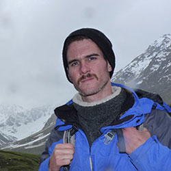
Calvin Metcalf - AppGeo
 When Worse is Better: Making a Dumb as Bricks App for Use When Everything Goes Wrong
About Calvin
I am a web developer, open source contributor, and civic hacker working at AppGeo making web applications with a geospatial focus. I live outside Boston with my lovely wife and in my free time enjoy strapping go pros to my cats and other productive activities.
Ben Guhin - City of Austin, Office of Innovation
Designing for 100% of America
About Ben
Ben joined the City of Austin in February 2016 to start a program to bring more designers, developers, and innovation leaders into city government. Previously, he served as a Senior Fellow for UX Design at the Consumer Financial Protection Bureau, and as an interaction designer for education, retail, and entertainment clients including Kaplan, Lowe's, and HBO GO.
4:30PM to 5:15PM
Lightning Talks
If you have something quick to share, come prepared with an idea of what you could present within a short 5-minute time slot and sign up for a lightning talk on-site at the event.
Lightning Talk Rules
- 5 minutes max – We will tightly enforce this.
- No external computer laptops or tablets - only browser based access to materials and links.
- Tips: Understand your topic – make your point at the beginning. You don't have to use all 5 minutes.
5:15PM to 5:20PM
Closing Remarks
5:30PM
Social TBA
Location & Parking Information
COMMONS LEARNING CENTER
at the J.J. Pickle Research Campus
10100 Burnet RdAustin, TX, 78753
Parking Pass
A parking pass is required at the Commons Center. Download, print and display prominently in your vehicle.
Download Parking Pass